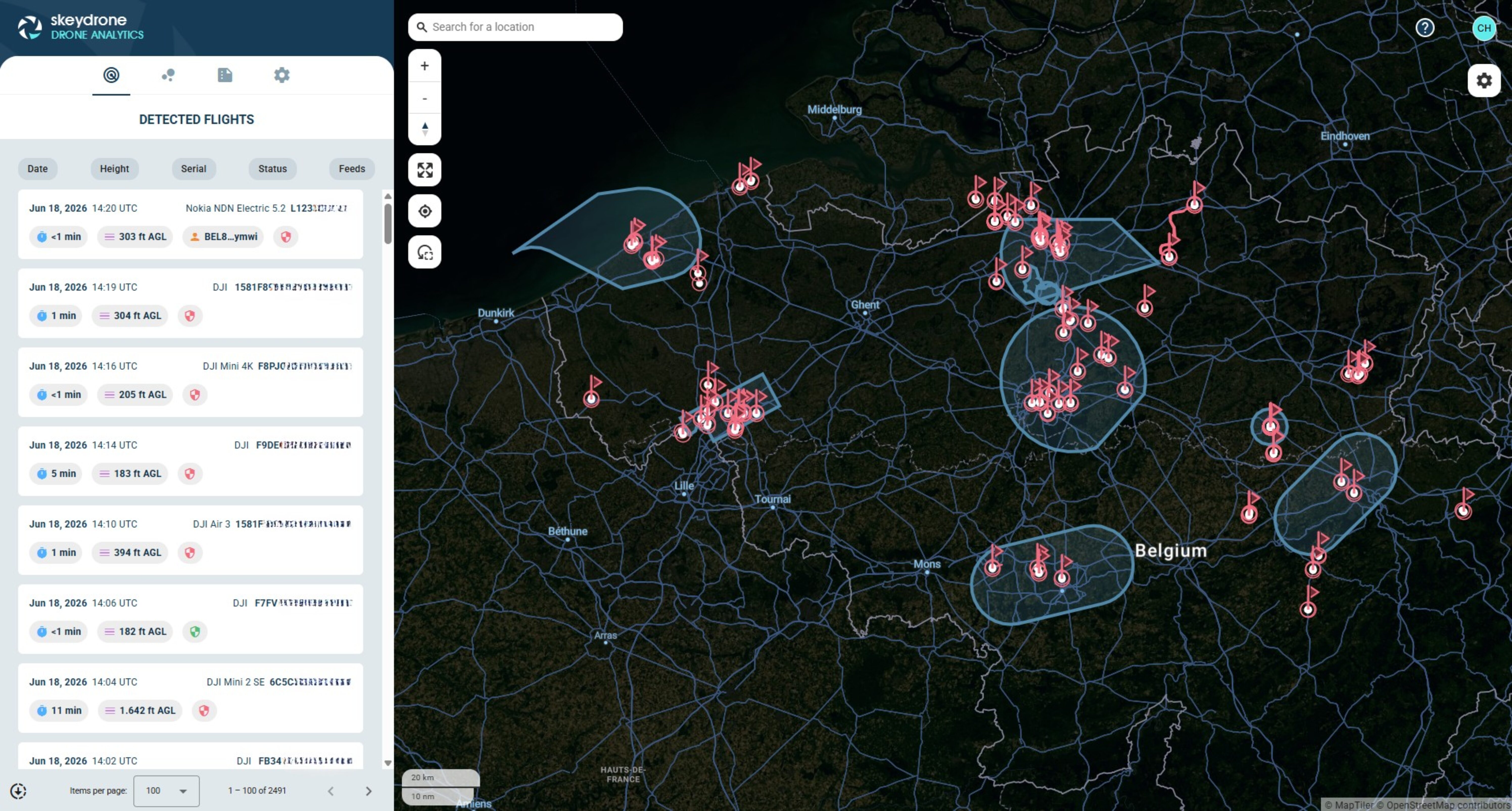
From raw detections to airspace insight
SkeyDrone Drone Analytics turns post-flight drone data into clear, reviewable intelligence – so teams can investigate incidents, prove compliance and understand patterns across their airspace.
— DETECTION DETAIL
Every flight, with the detail behind it.
The detections list gives you every recorded UAV flight, filterable down to exactly what you need. Open any flight to see the full operator, equipment and height detail gathered for it.
— STRUCTURED THREAT INTELLIGENCE
Replay any flight, point by point.
Reconstruct any detected flight on the map. Step through it, detection by detection, or watch the full path replay with altitude over time. Built for incident review and reporting.


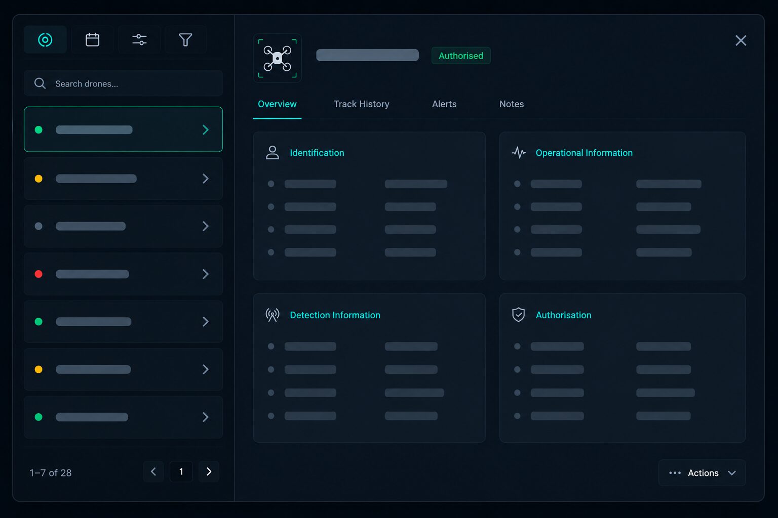
— AUTHORISATION INTELLIGENCE
Authorisation, captured at the moment of flight.
Every recorded detection is checked against the flight plans that were active at the time, and that verdict stays with the flight. When you review historical activity, each drone already carries its green or red shield, so you can see what was authorised and what wasn’t, without any manual lookup after the fact.
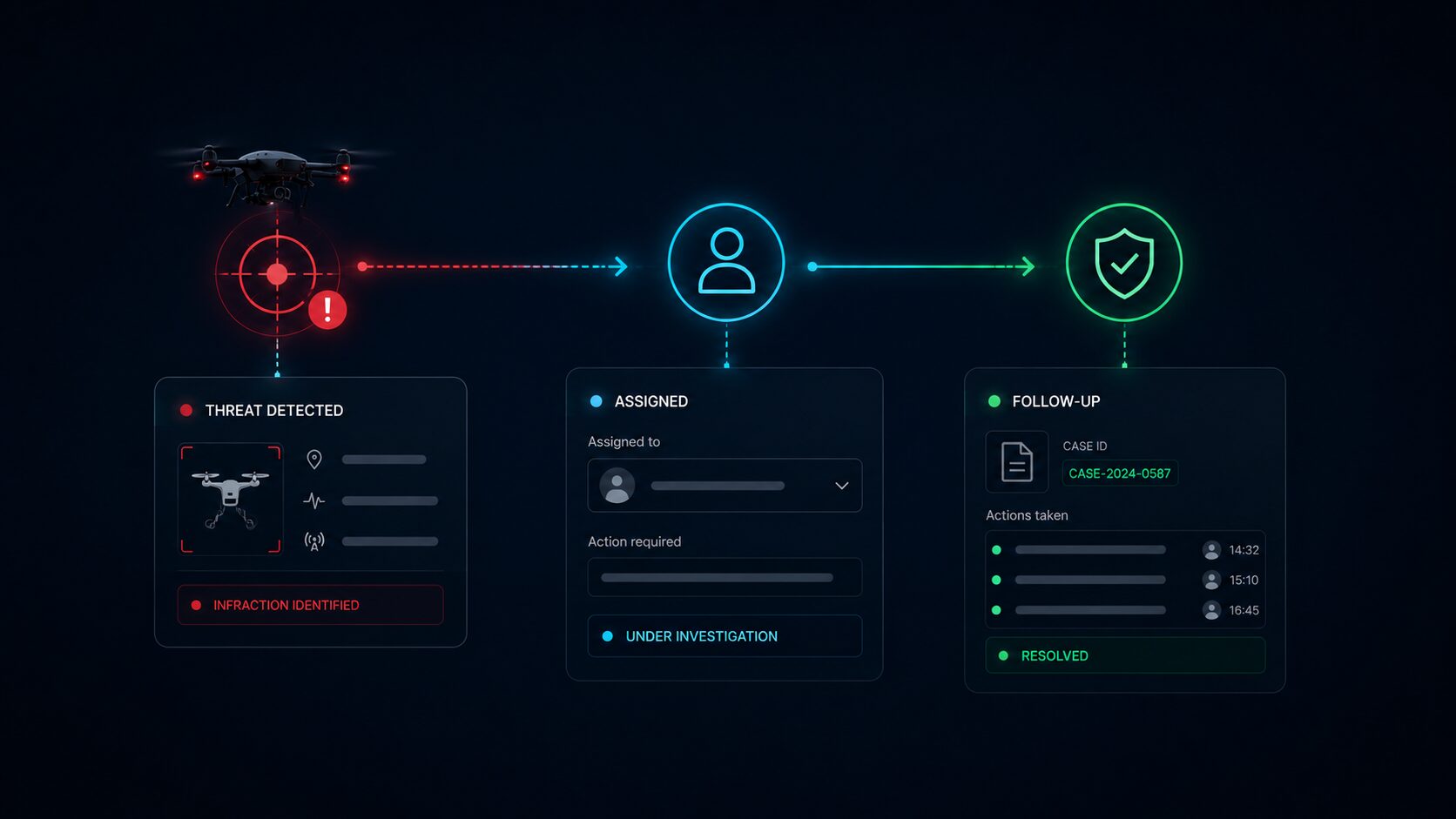
— CASE MANAGEMENT & FOLLOW-UP
From infraction to documented follow-up.
After an infraction, Drone Analytics helps you turn a detection into a documented case. Assign it to the right person, record the actions taken and keep a clear reference for follow-up, so nothing falls through the cracks once the drone is gone.

— SHARED FLIGHT ACCESS
Share the flight
Share a specific detected flight with anyone, even if they do not have access to Drone Analytics. The recipient gets the context they need to review the case, without requiring a platform account.
— BUILT FOR EVIDENCE
From raw detections to reports that hold up.
Export filtered flight data or a single flight as CSV or GeoJSON, and download heatmaps as images, turning recorded airspace activity into evidence and reports your team can act on.