A unified platform for lower airspace awareness
SkeyDrone transforms fragmented airspace inputs into clear, real-time operational understanding — so organisations move from isolated signals to informed, defensible decisions.
— THE PROBLEM
Fragmented data. Uncertain decisions.
Lower airspace is becoming increasingly complex, with multiple data sources, systems, and stakeholders involved.
Detection systems indicate presence. Authorisation systems indicate intent. But neither provides a complete picture. As result:
Airspace activity is difficult to interpret
Multiple data sources provide signals, but lack the context needed to understand what is really happening.
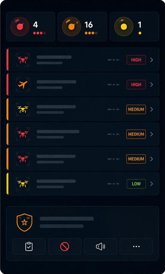
Alerts lack context and prioritisation
Operators are confronted with increasing volumes of information without a clear understanding of what matters most.
Decisions are made under uncertainty
Critical operational decisions must often be taken without a complete and trusted picture of the situation.
Disconnected systems create blind spots
Detection, authorisation and operational data remain fragmented across different platforms and stakeholders.
The challenge is not data availability. It’s the gap between a signal and a decision.
— THE PLATFORM
From data to operational understanding
SkeyDrone’s open-architecture software platform is hardware-agnostic and integrates multiple sources into a single,
coherent view of lower airspace.
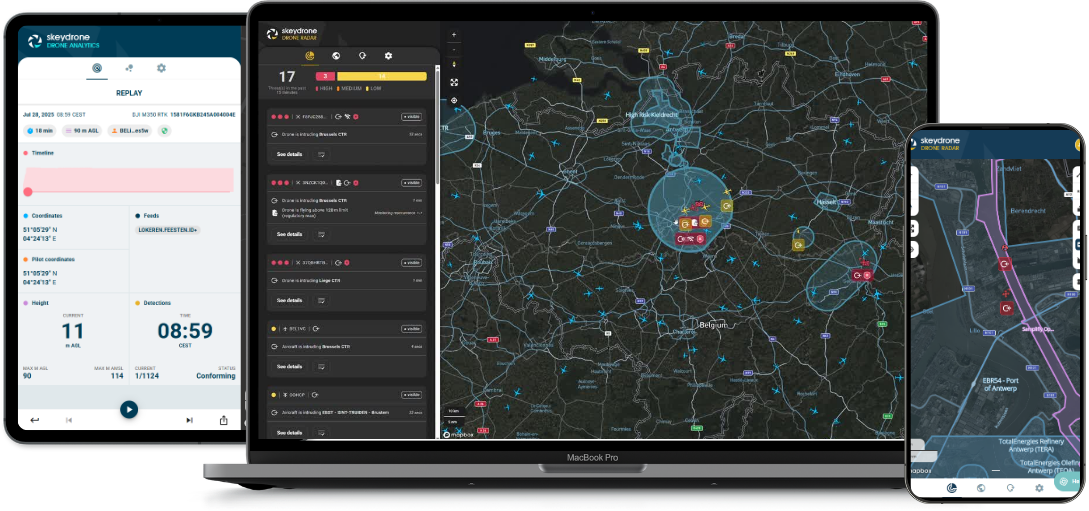
Not more data. A single, structured picture you can act on.
— HOW IT WORKS
From signal to decision:
the DITTA methodology
The platform applies the DITTA™ methodology to transform inputs into operational insight:
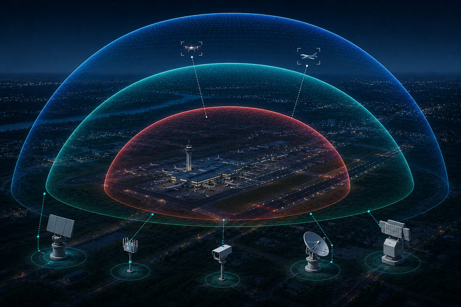
Detection
Noticing a drone is present in the air and displaying it on a digital map in real time.
Identification
Determining its type, serial number, authorisation status and operator ID.
Tracking
Following its position, movement and behaviour over time to understand patterns.
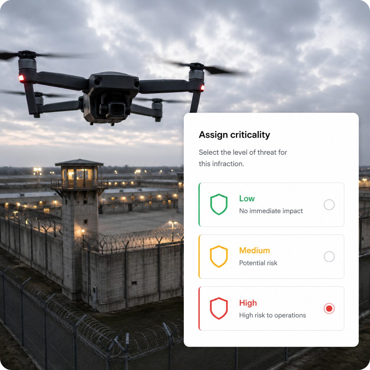
Threat Assessment
Deciding whether it poses a credible risk based on its behaviour.
Action
Initiating an appropriate response based on the assessed level of risk.
Every activity in your airspace is understood in context, not in isolation.
— CORE CAPABILITIES
Built for real-world operations
Our platform combines four core capabilities: a unified airspace picture for complete real-time visibility, contextual intelligence to understand what each detection means, real-time assessment to prioritise risks and opportunities, and decision support to guide fast, proportionate and defensible action.
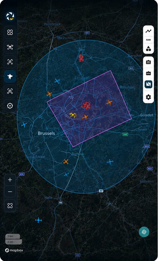
1 – Unified airspace picture
A single, real-time view of all airspace activity in one interface.
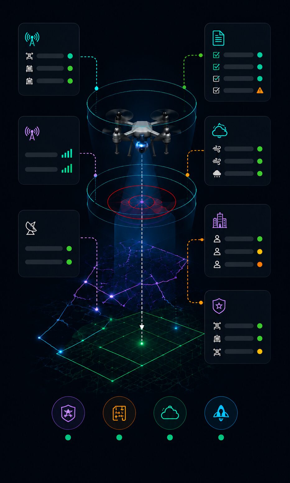
2 – Contextual intelligence
Understanding not just where a drone is, but what it means in context.
3 – Real-time assessment
Continuous evaluation of relevance and potential impact.
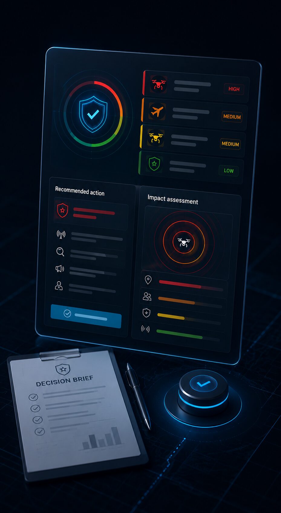
4 – Decision support
Clear, structured outputs for fast, defensible decisions.
— DESIGNED FOR INTEGRATION
Fit into your operational environment
The platform is built to integrate into existing systems and workflows.
— OUTCOMES
Clarity at the moment it matters
Confidence for every operation in lower airspace.

— WHAT TO RETAIN
Bring clarity to your airspace

Discover how the SkeyDrone platform supports real-time airspace understanding across your operations.