As drones increasingly operate near critical infrastructure, international airports and Air Navigation Service Providers (ANSPs) must adopt effective strategies to ensure airspace safety and security. In this recent webinar, we presented how a fully EASA-compliant drone incident management system is deployed at Brussels Airport.
- David Van Acker, Senior Tower Manager at skeyes, outlined the concept of operations behind the initiative.
- Didier Decaestecker, Head of Sales at SkeyDrone, demonstrated how EASA guidance has been translated into a robust, operational drone detection system.
- Yves Brouwers, Senior Consultant in Safety & Emergency Management at Airport Intelligence, shared best practices for responding to drone threats while ensuring safe and continuous airport operations.
Q&A overview
While the webinar recording doesn’t include the Q&A segment, fear not! We’ve compiled the most pressing questions and expert answers below, organised into three key themes:
1. Detection System: How It Works
Q: You are using several sensors to detect drones. How are the different sensors fused together in the final detection of drones?
A: Several drone detection sensors are indeed connected to our system. Multiple sensors are required to cover larger areas or to detect drones at different heights in demanding environments (e.g. urban areas or hilly terrain). The data from the different sensors are fused together into a single drone object in the data fusion layer by taking into account time, position and drone characteristics such as serial number. This prevents displaying the same drone multiple times on the screen.
Q: How do you distinguish authorised from unauthorised drones?
A: This is done via the the Uncrewed Traffic Management (UTM) integration. In the UTM system, drone operators submit their UAS Serial Number, flight plan and timing. When a drone is detected in the area and at the time of an authorised flight, using the correct device, the detection system automatically recognises it as “authorised”.
Q: How does your detection system differentiate between birds and drones in the air?
A: We detect cooperative drones via their direct remote id. For non-cooperative drones, we use Radio Frequency (RF) analysis, extracting all the information from the RF communication between drones and their remote control. This way we can detect all commercially available drones of which we have a fingerprint in our decryption database which is continuously updated. Unknown types of drones are signaled, and can be located when detected by multiple antennas (principle of multilateration). Birds are only a concern to active radar systems, as they don’t get detected via RF.
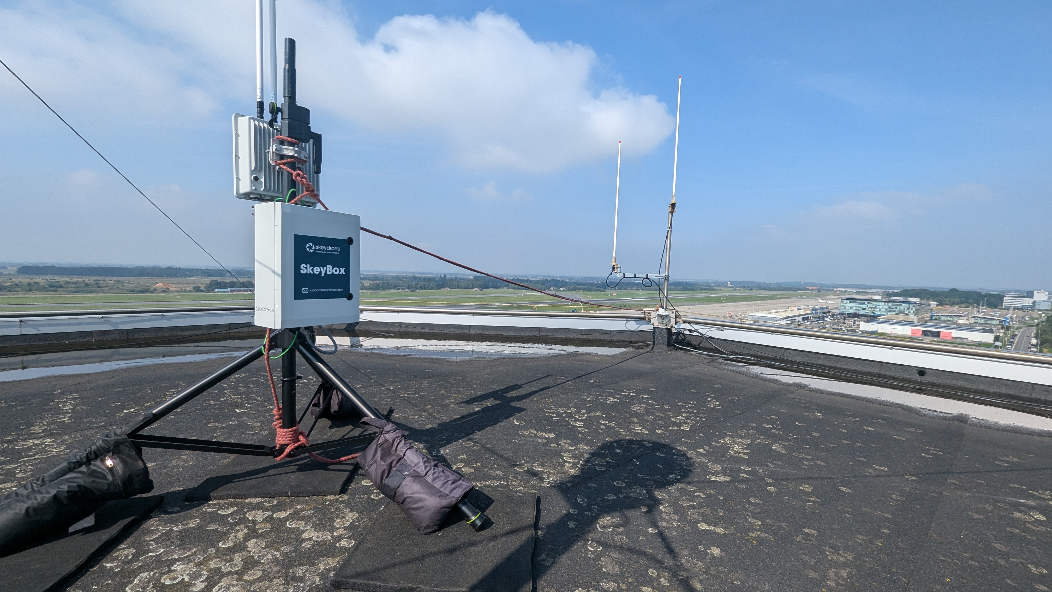
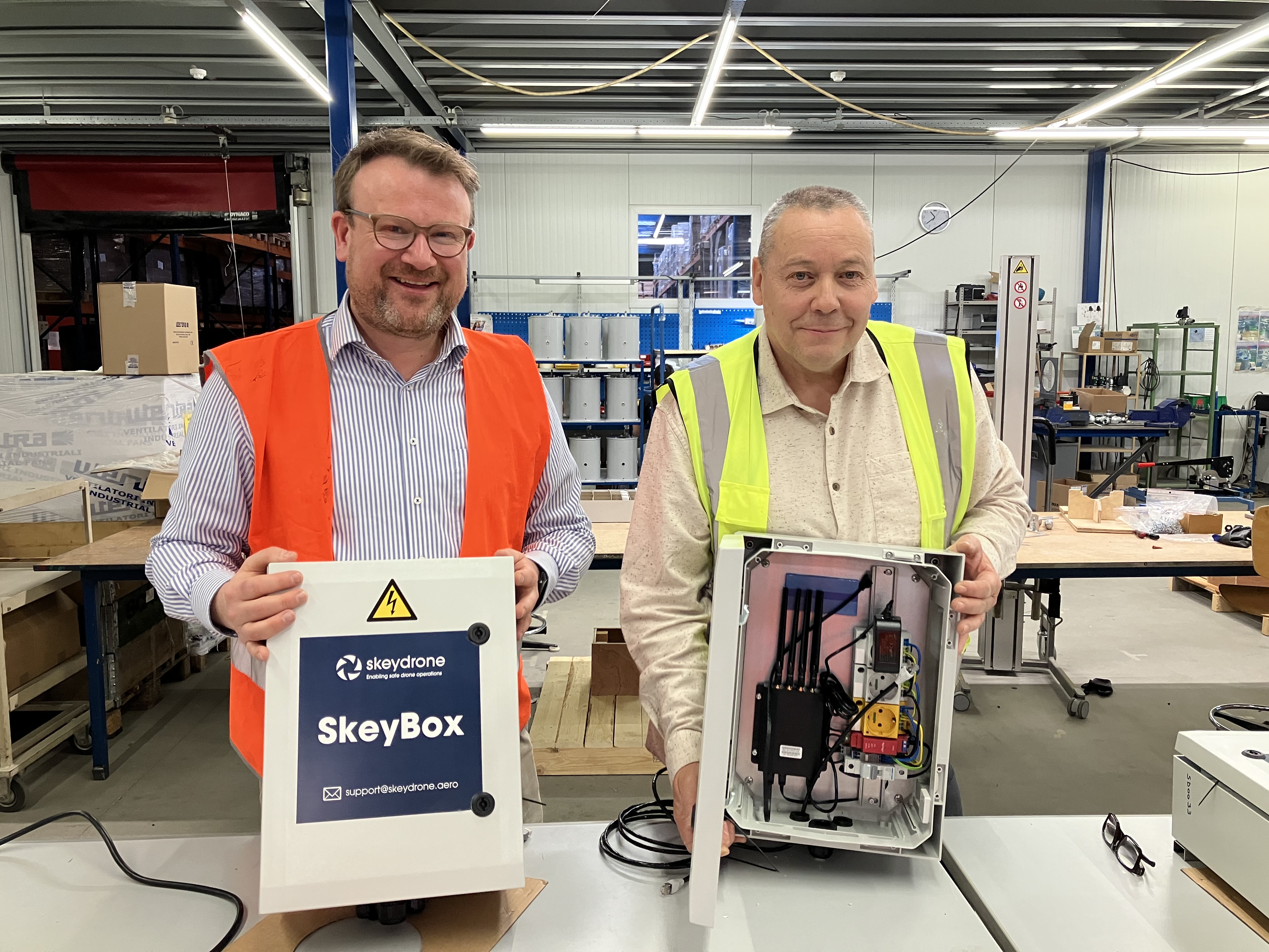
Q: Did you have to deploy specific hardware to detect the RF signals between the drones and the remote control? And how do you differentiate at proximity of airports inside the EASA zones whereas if the RF signal is coming from a remote control or not?
A: We installed several SENid+ sensors in the airport area. The RF signals are going in two directions, emitted by the drone towards the remote control, or emitted from the remote control towards the drone. The system intercepts both signals and by reading the data inside the signal, we can determine the location and height of the drone, but also the location of the remote control. This allows not only to make the user aware of the location of the drone in the air, but also the valuable location of where the pilot that is controlling the drone is located.
2. Threat Zone Configuration
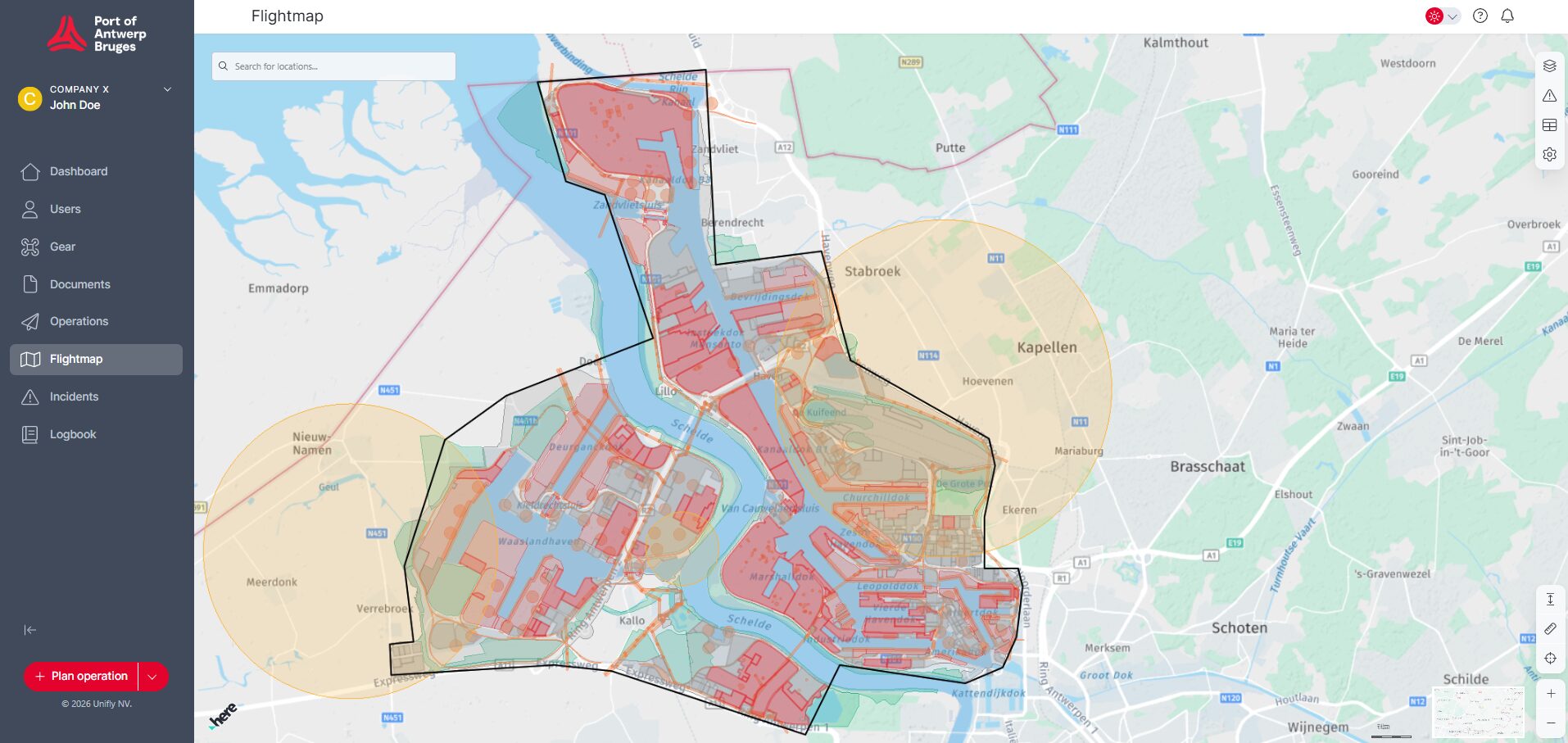
Q: How do you define those red, orange and yellow threat zones?
A: We used the guidelines from EASA that are available for ANSPs, and translated those to the context of Brussels Airport. By doing so, we’ve reduced the number of drone detections that need to be looked into with 97%. We want to make sure we only divert airplanes or close runways or the airport when we absolutely have no other choice.
Q: To what distance at the end of the runways do you monitor? Do you use the same criteria for cooperative/non-cooperative drones in those areas, or do you class them all as ‘red’?
A: The red threat zone extends up to 1852 meters. While drones are not allowed in the proximity of an active runway, occasionally the police receives authorisation from the tower to fly at a low height of about 20 meters. These flights would show as red in the system, but since the tower is aware, this obviously wouldn’t be a threat. Only unknown drones trigger a reaction.
3. Responding To Threats
Q: When an alarm from detection system arises in the red zone:
1. How do you discard that it is or is not a false alarm?
2. How much time do you spend to do this analysis and discard the alarm or not?
3. What it is the operational decision during that time you use for analysing the truthiness of such alarm? Do you stop the operations during that period?
A: 1. All detections are real. An alarm is generated if there’s no authorisation in the UTM system or if the operational volume is not respected. However, if there would be exceptionally contact with the drone pilot and the actual mission was known and approved, the alert would be disregarded.
2. The system is built in a way so the alert is pretty straight forward and allows for quick response times. Instantly after the alert, a phone call would be made by the user of the drone detection system towards ATC to check the situation.
3. A phone call to the tower supervisor would almost instantly lead to a quick analysis and response by Air Traffic Control (ATC). Possible responses include suspending or delaying flight operations, closing affected runways, redirecting or rerouting traffic.
Q: How is follow-up and enforcement organised? Detecting is the first step but how is the drone owner apprehended? What role does surveillance and police have?
A: The first action is to alert ATC when a drone is detected at the airport. We have special procedures in place for intrusion, which will be deployed in a first phase. These procedures include a cooperation between ATC, Security and Aerodrome Operations, and Airport Police. This procedure is activated to make sure aircraft and staff are safe and secure. In a second phase, we will warn the central dispatching of the police so they can send a team to the location of the pilot, since the drone detection system displays the location of the pilot. While some drone flights might be too short for that, SkeyDrone’s Drone Analytics module offers the possibility to analyse all details of past drone flights which can be shared with the police or the Civil Aviation Authority after the facts for prosecution.
We’d like to thank everyone who attended the webinar and contributed to the lively Q&A. If you missed the session or want to revisit it, you can access the recording here.