At SkeyDrone, we believe that great user experience isn’t just about big features—it’s about the little things that make your day smoother. That’s why we continuously refine our solutions to make them more intuitive, reliable and aligned with the needs of our users.
This week, our engineering team has rolled out a set of updates focused on refining the user journey and squashing bugs that were getting in the way. Several of these improvements were inspired directly by your feedback, underscoring how closely we listen to and act on your input.
For professionals who rely on our drone detection technology, every detail counts. Whether it’s monitoring airspace activity, analysing data, or coordinating operations, efficiency and clarity are essential. Our goal is to make sure the platform not only delivers accurate insights, but does so in a way that feels seamless.
What’s New?
In Drone Analytics
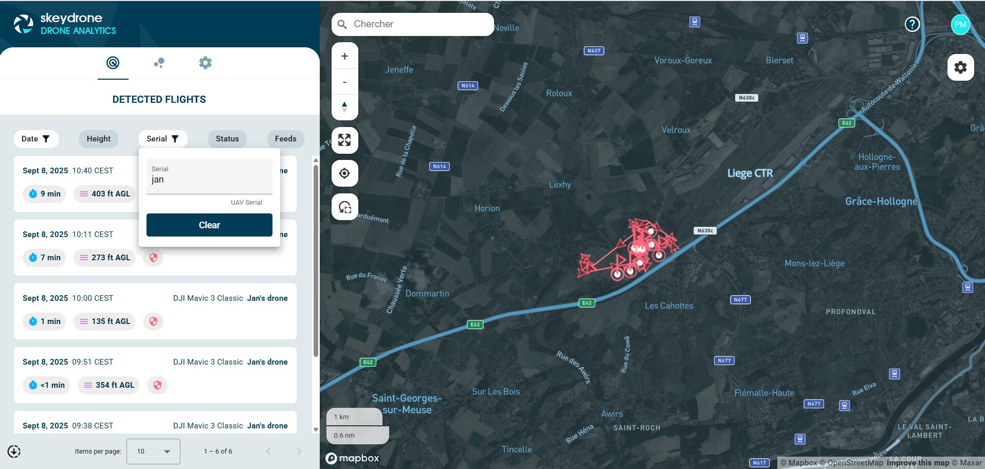
- Custom labels created in Drone Radar are now available in Drone Analytics too (see header image) so you only label flights once, keep the same context across both tools, and more easily identify your drones.
- The map no longer zooms out when deselecting a flight so you keep your focus and don’t lose your view of the airspace.
- Mobile users can now dismiss the login popup on the public view by tapping the “Close” button so you can easily close it and switch to full-screen flight view.
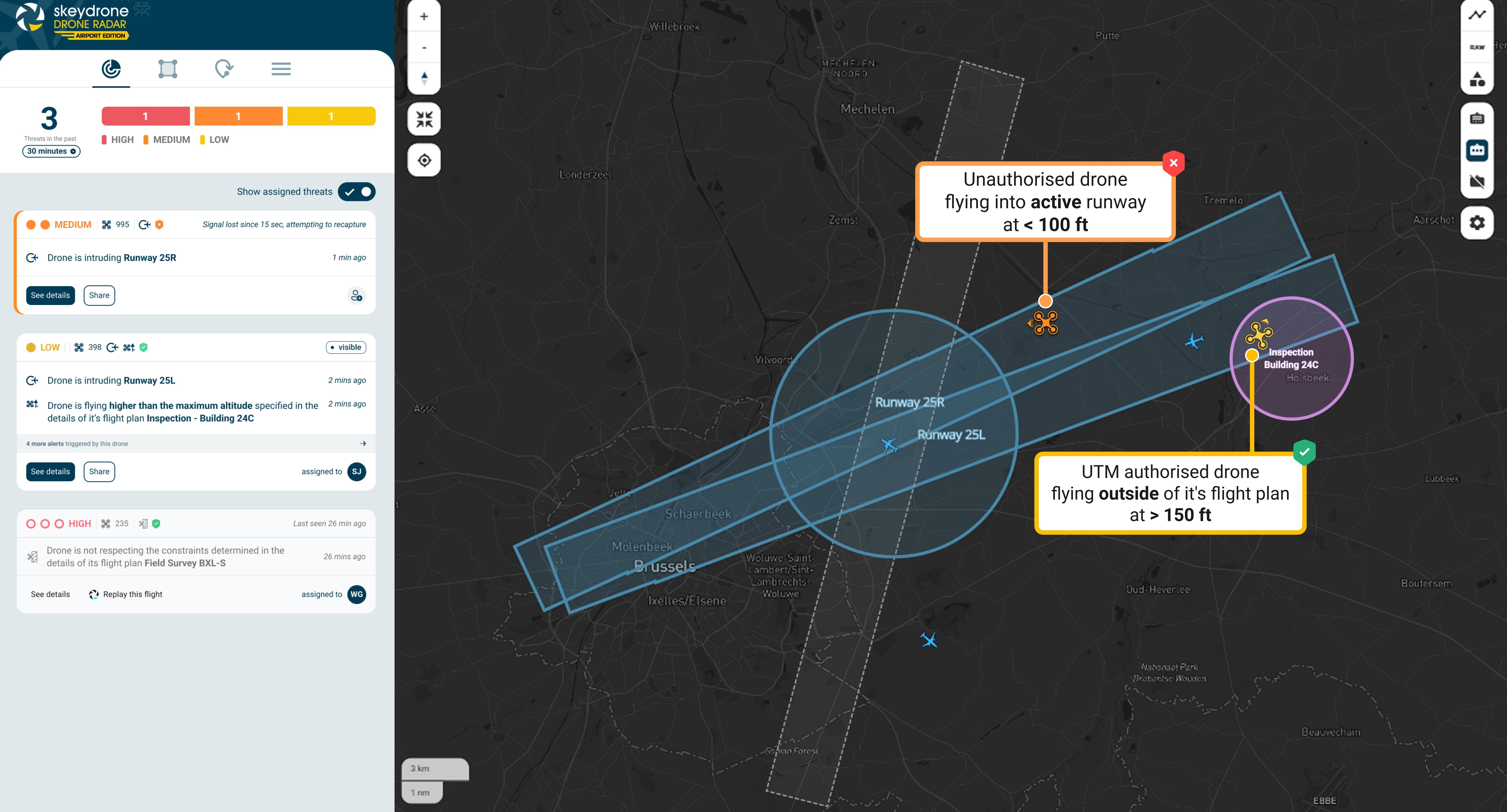
In Drone Radar
- You can now select the map style when creating or editing a control zone so you can choose the background that best fits your needs when defining a zone.
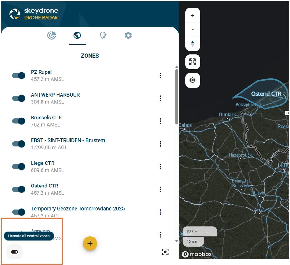
- All control zones can be toggled on or off with a single checkbox so you can declutter the map instantly and focus on what matters (see image below).
- When you restrict traffic to manned, the unmanned traffic settings are automatically disabled and your configuration stays consistent.
- The GCS abbreviation on the map is now displayed in full as Controller so terminology is clear for everyone, especially new users.
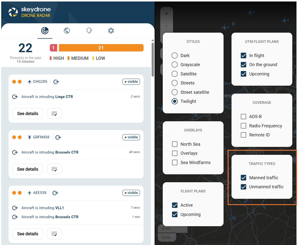
- You can now choose which type of traffic to display on the map—manned, unmanned, or both so you can focus on the airspace view of interest to you, without affecting the threat panel (see image below).
We’d Love Your Feedback
Your feedback plays a crucial role in shaping our products. If you have suggestions for further improvements, please submit them directly in the Hub, using the dedicated button from the Help Center.