For all pilots, whether flying crewed or uncrewed aircraft, situational awareness is everything. Knowing who else is in the air, and where they are is not a “nice to have”; it is a prerequisite for safe operations.
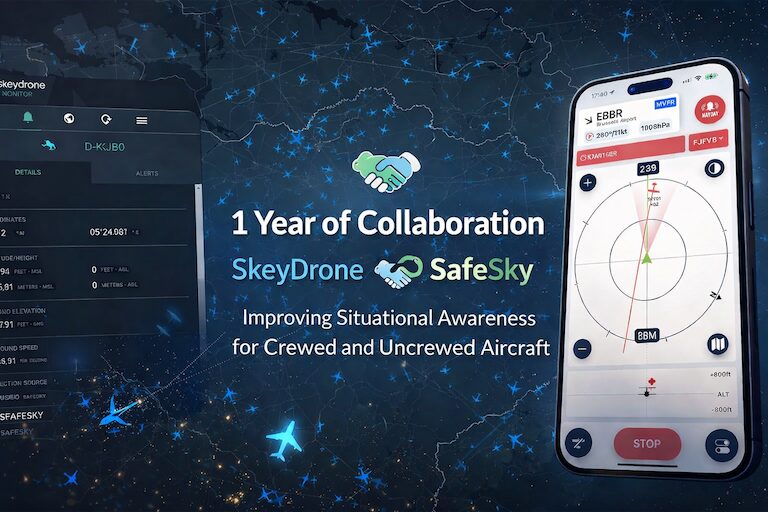
One year ago, SkeyDrone and SafeSky announced a strategic partnership enabling bidirectional data exchange between both platforms. The collaboration marked an important step towards improving airspace awareness and safety, as the skies become increasingly shared between crewed and uncrewed aircraft.
One Integration, Two Outcomes: Safer Drone Flights and Stronger Site Protection
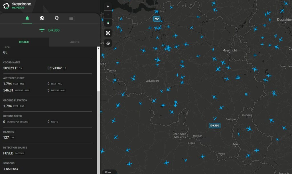
Through this integration, SkeyDrone’s Traffic Information Service has been enriched with real-time in-flight traffic data from the SafeSky platform, including helicopters, gliders, paramotors, paragliders, trikes, and other aircraft. This directly improves situational awareness for drone operators, particularly when conducting missions beyond visual line of sight (BVLOS) and especially in airspace where drones and crewed aircraft operate in close proximity.
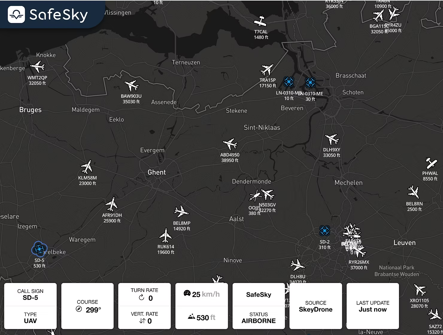
In parallel, through the SafeSky UAV API, SkeyDrone’s drone detection solution now also displays drone flights in locations that fall outside the reach of the existing sensor network, including operations across the Dutch and Luxembourg borders. Over the past year alone, this integration has resulted in more than 3,250 additional drone flights being displayed in the SkeyDrone platform, flights that would otherwise have remained unseen.
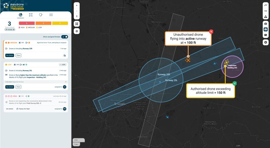
This expanded coverage is advantageous not only for drone operators flying BVLOS, but also for geozone and security managers utilising SkeyDrone to safeguard their sites from unauthorised drone activity. The SafeSky integration marks significant progress toward achieving comprehensive nationwide drone detection capability in Belgium.
Kristof Gilleman
Head of Operations at SkeyDrone
Through this partnership, we support BVLOS drone operators dependent on our Traffic Information Service, while also empowering geozone and security managers who use SkeyDrone to protect critical sites from unauthorised drone activity. The integration with SafeSky represents a major step towards a complete, nationwide aerial picture in Belgium.
Closing an Important Gap: What’s in It for Pilots?
Traditional aviation surveillance systems, such as ADS-B, Mode S, FLARM, were never designed with widespread drone integration in mind. While many professional drone operations today are fully authorised and compliant, yet from a cockpit perspective they may remain non-cooperative. They do not broadcast their position via standard aviation protocols, making them invisible to conventional traffic awareness tools. For VFR pilots operating below controlled airspace, where helicopters, training aircraft, gliders, microlights, and drones increasingly share the same airspace volume, this creates uncertainty. And uncertainty, in aviation, is always a risk factor.
By integrating drone detection outputs from SkeyDrone with the SafeSky APIs, SafeSky can provide live telemetry-based awareness of certain drone operations that would otherwise not appear on traditional aviation displays. And this is not about replacing “see and avoid”; it is about enhancing awareness in an environment where visual acquisition alone is no longer sufficient.
Tristan Fily
CEO at SafeSky
The future of aviation depends on crewed and uncrewed aircraft sharing the sky safely. This partnership with SkeyDrone demonstrates how interoperability can turn that vision into practical awareness for everyday pilots.
Looking Ahead — A Shared Vision for Connected Airspace
Airspace is evolving. The lower altitudes are becoming more dynamic, more diverse, and more operationally demanding. What used to be a largely homogeneous traffic environment is now a mixed ecosystem of recreational pilots, professional drone operators, emergency services, aerial work missions, and new mobility concepts. In this context, safety increasingly depends on interoperability.
The first year of operational data exchange between SkeyDrone and SafeSky demonstrates that bidirectional interoperability is not only technically feasible: it is operationally valuable. It enables visibility where it was previously limited. It reduces uncertainty where blind spots existed. And it lays the groundwork for a more unified airspace picture.
Belgium may be geographically small, but collaborations like this show how local innovation can have international relevance. By connecting ecosystems rather than competing in isolation, SkeyDrone and SafeSky are contributing to a broader shift in aviation: from fragmented visibility to shared awareness.
Both companies remain committed to expanding this cooperation, embracing cooperative and non-cooperative drone visibility, strengthening interoperability, and working with partners across the aviation and UAS community.
Learn more about SkeyDrone’s Traffic Information Service here.